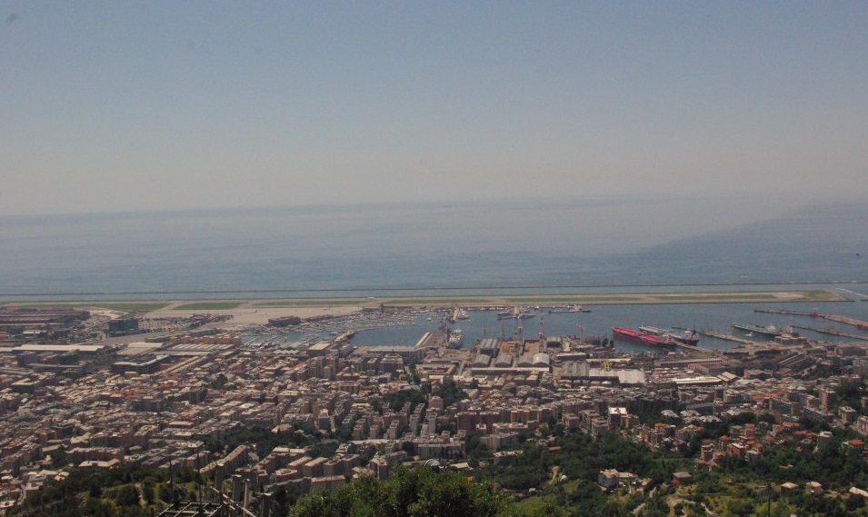
From Genoa by car in just over half an hour you can reach Paradiso Gulf along the Aurelia road (SS1) and its two villages known all over the world: Camogli and Portofino.
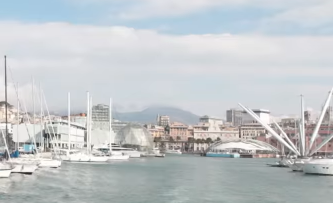
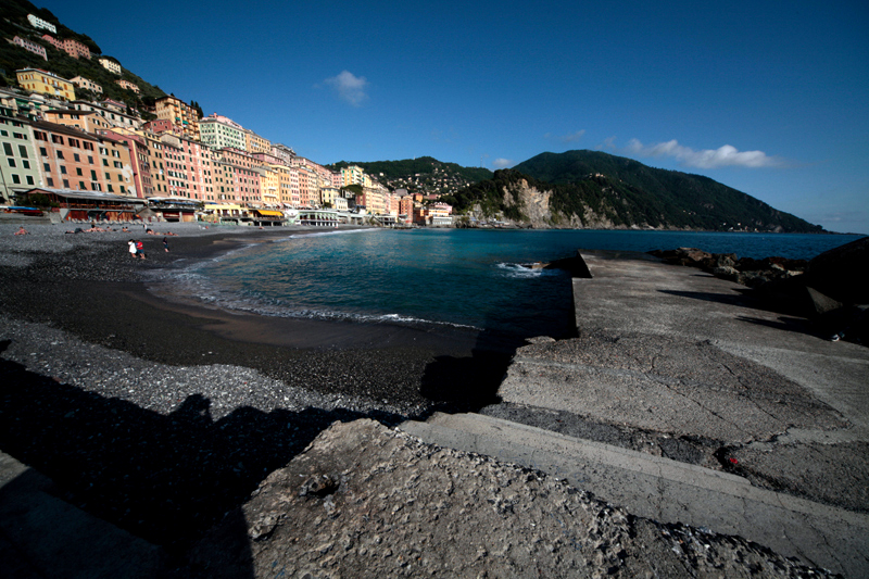
Camogli is a pearl in the Paradiso Gulf. Its name has uncertain origins, as many hypotheses have been made… It could come from ‘casa delle mogli’ (‘house of the wives’), those women who waited for their husbands, fishermen, to come back. Or it could derive from ‘case a mucchi’ (‘cà a muggi’, in the Genoesedialect, i.e. ‘heaps of houses’), with its typical houses next to one another which defend themselves from the sea which brought both life and death. The Camogli houses, in a long stretch, have up to 10 floors with an entry towards the seaside and another one on the road, on the 5th or 6th floor, where roofs, balconies and parapets blended into one another. The last sea fortress, Castel Dragone or della Dragonara, built in the 12th century, rises on a rock called ‘the island’ because this is what it used to be… The huge Assunta church, built in 1220, also stands out. Next to the church is the port from which boats to Genoa Porto Antico, San Fruttuoso, Portofino, Sestri Levante and 5 Terre depart.
Ruta di Camogli
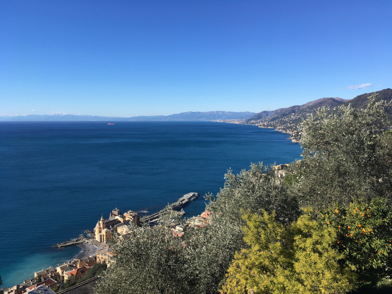
Ruta is an ancient village stretching along the ridge dividing the two sides of the Portofino promontory. As it sneaks into the villas and old rural estates that have been turned into very expensive buildings, the Aurelia road (SS 1) connects Recco to Rapallo whilst giving breathtaking views of the Paradiso gulf. This segment is so peculiar that the phrase “Ruta di Camogli” is often used to refer to the panoramic road and not the village of Camogli. Chiesa Millenaria is situated close to the Ruta tunnel.
San Rocco di Camogli and San Fruttuoso Abbey
The small San Rocco village lies 220 metres above sea level. San Rocco is a corner of paradise. It can be reached from the Aurelia road by turning right before entering the Ruta tunnel. In alternative, it can be reached on foot from Camogli by climbing up viale dei Cipressi and via San Rocco. When you reach the top, you will be standing in the Chiesa di San Rocco square. You will be presented with a vast horizon, at the end of which sky and sea almost seem to merge. By accessing via Mortola and the stairway to Porto Pidocchio and Punta Chiappa (the last stretch of land of the Portofino promontory) you will reach the medieval church of San Nicolò Capodimonte, immersed into the green overlooking the sea. Sanr Rocco is the starting point of the Portofino promontory hiking trails, 80 km of routes with different levels of difficulty to reach on foot Portofino, San Fruttuoso abbey and Santa Margherita Ligure.
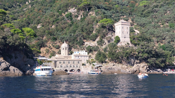
The San Fruttuoso abbey, famous all over the world, is set in an inlet in the Portofino promontory. The monastery was built in 948 over the debris of another pre-existing convent. It was given to Benedictine monks in 1200, when the monastery reached its peak.
Translated by Daniele Canepa